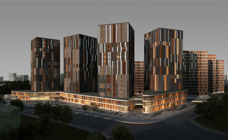
Masterplan and urban regeneration
Starting from a territorial analysis of the municipality, this intervention covers an area of over 3,000 hectares. The project includes both the urban planning of new districts and a special report for the regeneration of the city centre.
Luis Aguirre
Ruan Dan
Lv Jin Huan
James Tendayi Matsuku
Diego Laguía
Liu Xiao Pu
Zhang Zhang
Area: 3.000 Ha.
Location: Pengshui, China
Client: Local government of Pengshui
In collaboration with LKS Ingeniería S. Coop and GP&D
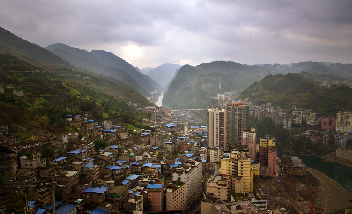
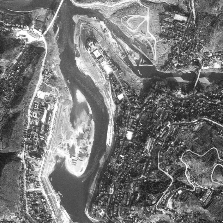
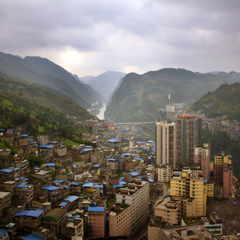
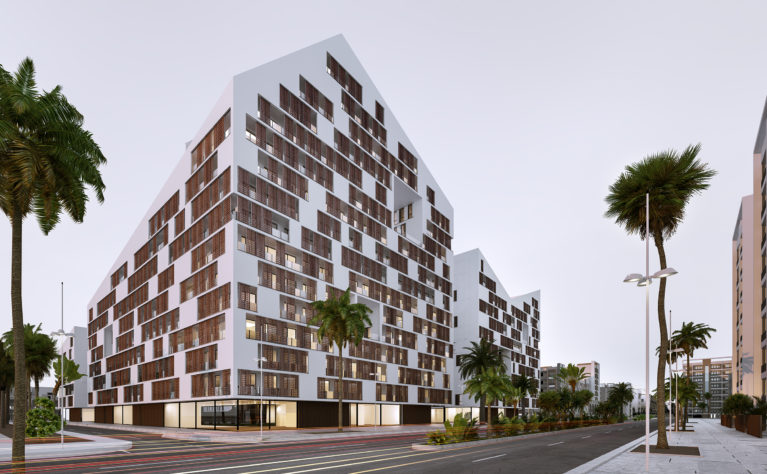
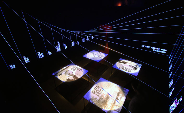
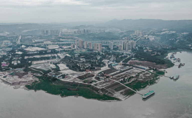
Pengshui is a city of about 100,000 inhabitants, located in the Chinese municipality of Chongqing. In the latest years, this urban centre has experienced an extraordinary increment of population, mostly driven by the recent improvement of the public infrastructures and of the regional economic policies. Indeed, within the next ten years, it is foreseen a dazzling 200% population growth.
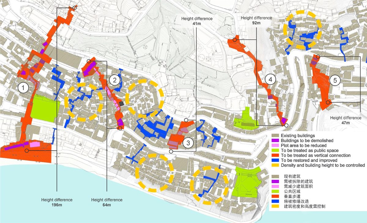
From the beginning, the city’s development has been strongly affected by the local, rugged topography. The overall shortage of flat land is the main reason for the uncontrolled process of urban densification in the city centre: a density which later has spread as a sprawl in the nearby valleys; a fragmented and polycentric structure of five separate neighbourhoods.
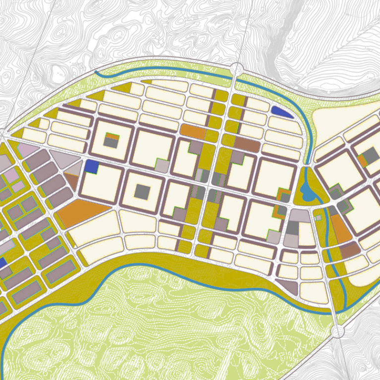
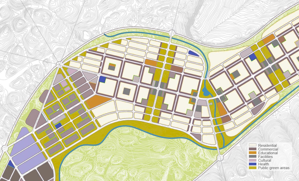
The intervention starts with a territorial analysis of the municipality to determine the economic factors driving the urban growth, and the relationship between the capital and the adjacent towns. The metropolitan area will be divided into several zones marked for new development: the most important are Boajia, Changtan and Dianshui.
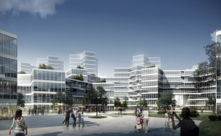
The masterplans of these neighbourhoods are always designed considering the connection with the main city: especially the hierarchy of the mobility system, and the urban density of the territory. The result is the model characteristic of a new, different city, where residential typologies adapted to slopes and irregular grounds.
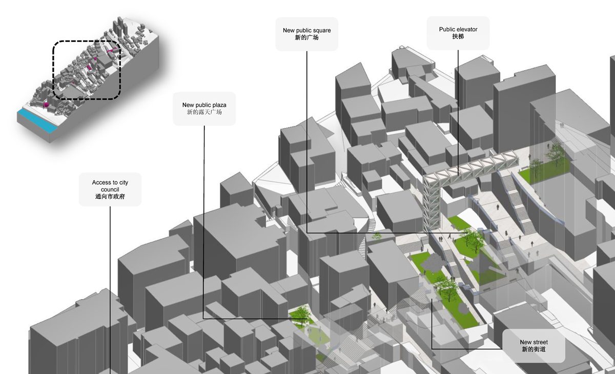
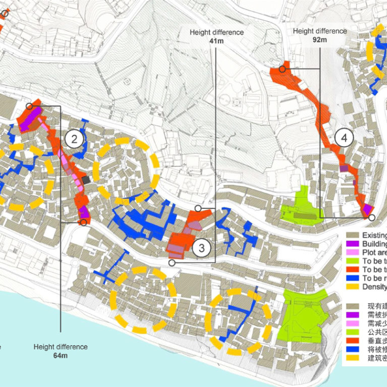
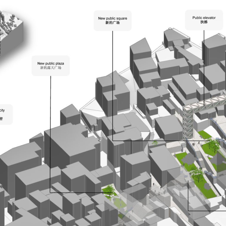
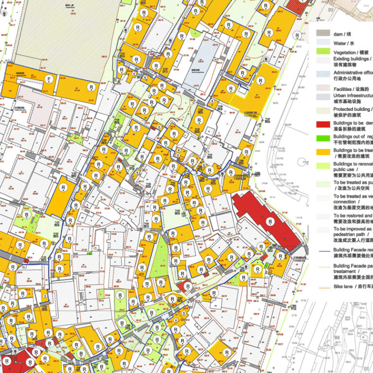
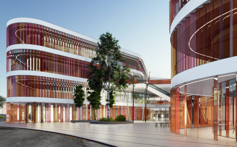
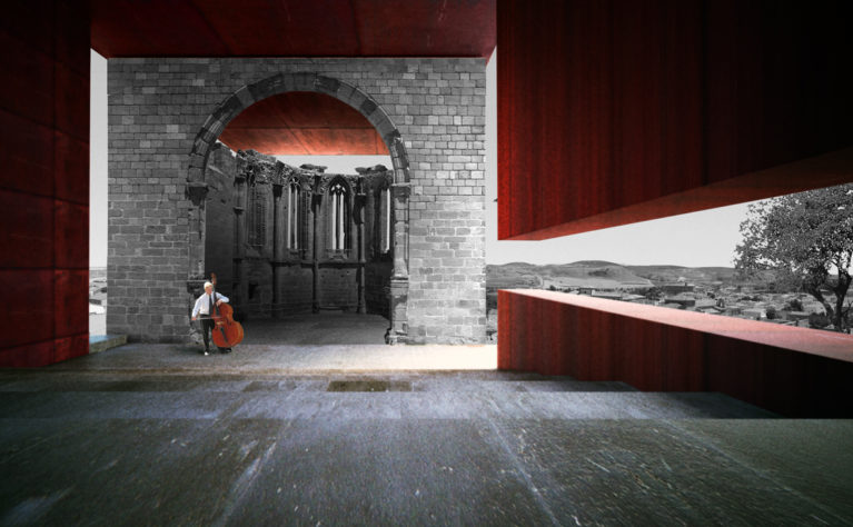
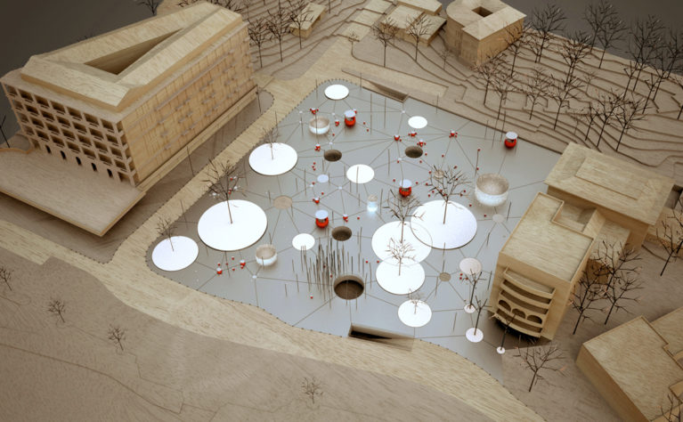
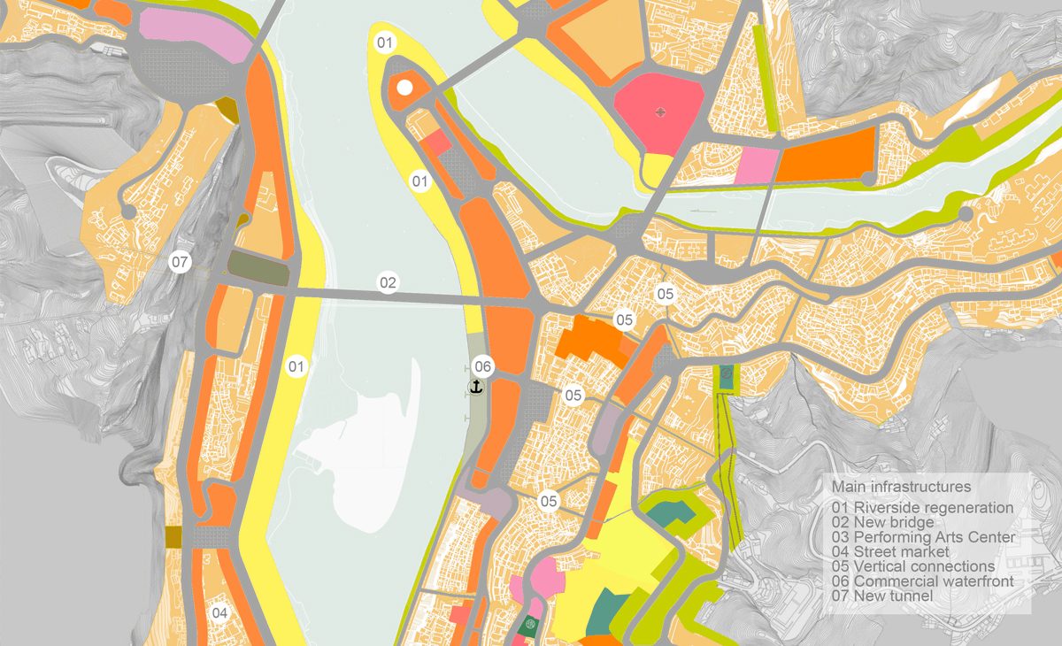
On the contrary, the intervention in the centre is thought as a process of urban regeneration. The self-built housing process that took place on the slopes has resulted in highly densified zones. The project starts with a deep study of the urban fabric to propose the opening of new roads, insertion of public spaces and comprehensive land use optimization.
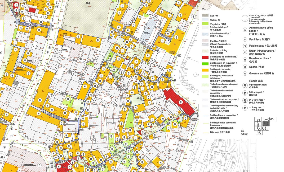
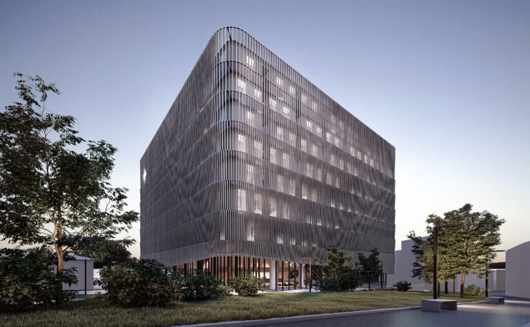
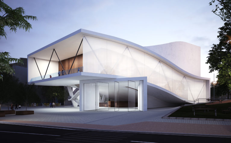
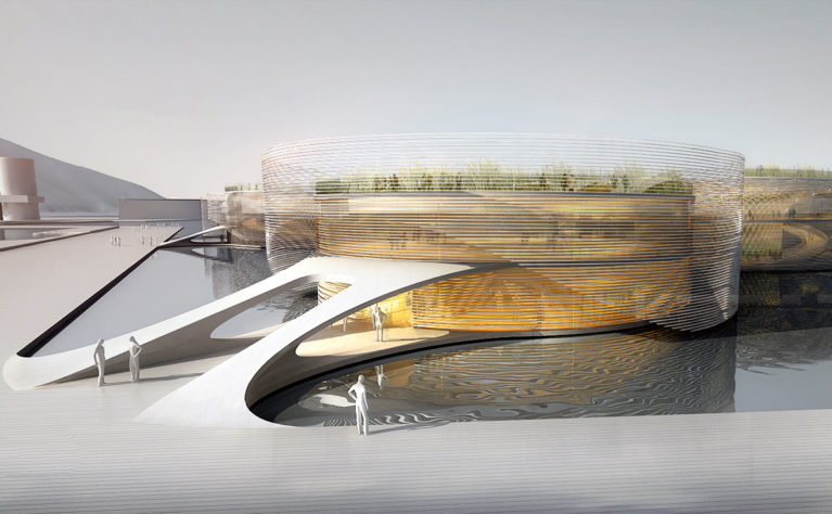
This strategic plan is also completed with other specific interventions for improving the image of the city such as the treatment and regeneration of the riverbanks, (affected by seasonal changes in water level), or the proposal of certain public buildings in strategic areas to become driving forces in the regeneration process.