In the context of architectural photography and visualizations, a bird’s-eye view is a perspective that shows a building or area from above, as if you were looking down on it from the sky.
This type of view is often used to showcase the layout and design of a building or area, and can be particularly effective for showing the relationship of the building or area to its surroundings. Bird’s-eye views are often used in marketing materials for real estate properties, as well as in architectural renderings and other visualizations.
These views can be created using a variety of techniques, including aerial photography, drone photography, or computer-generated imagery (CGI).
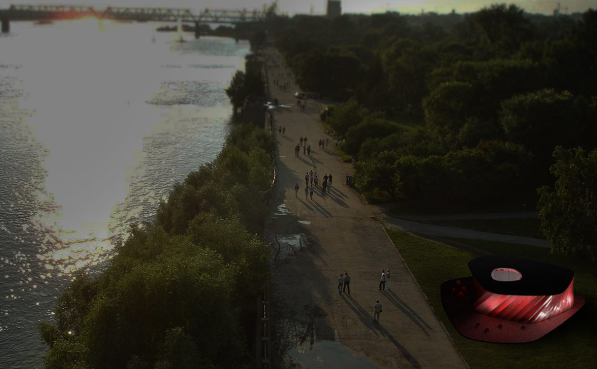
wavescape pavilion
the birdview
The pavilion occupies a central position in the bay in front of the thematic exhibition site. From the pavilion’s terrace, you can see the marina, the quay and the breakwater.
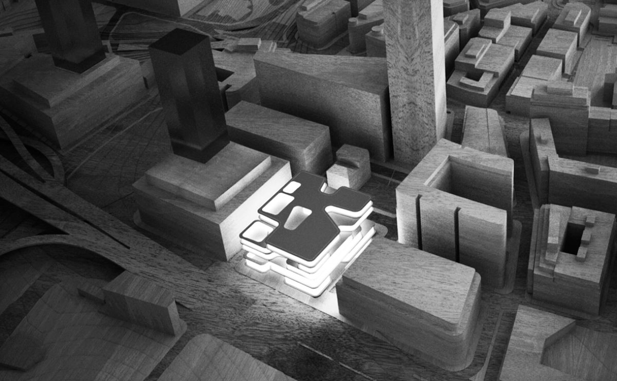
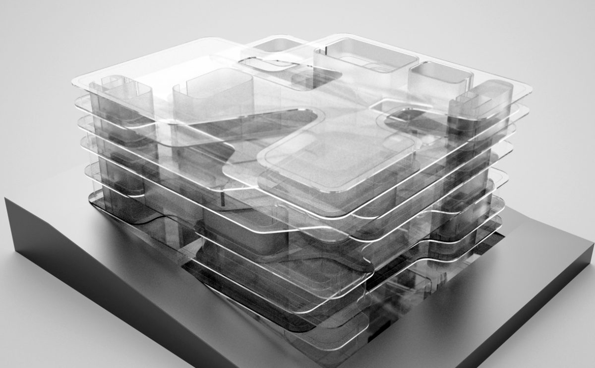
market eight
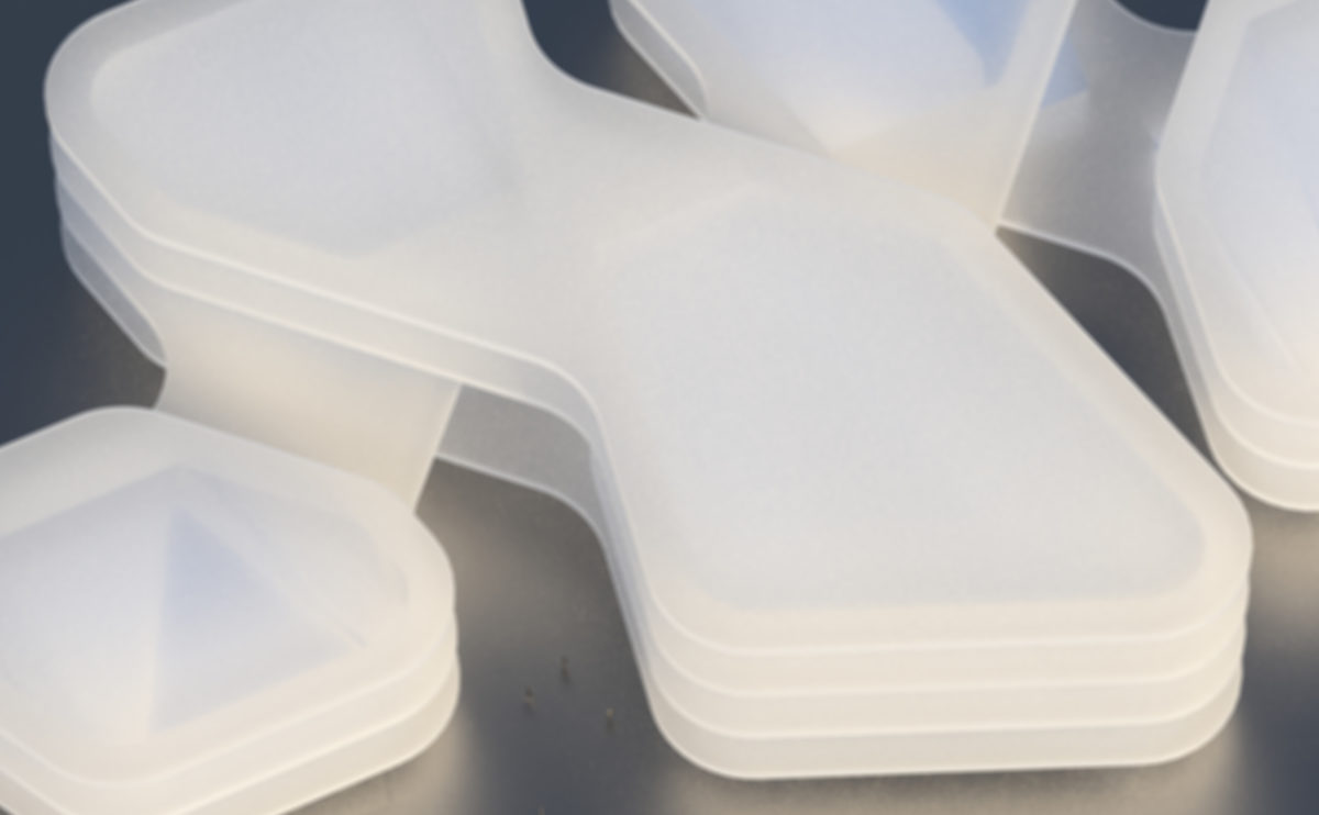
the conceptual physical model
This conceptual physical model made of translucent layers of acrylic shows the relationship of the building with the courtyards, the vertical circulation and the interlacing bridges between blocks.
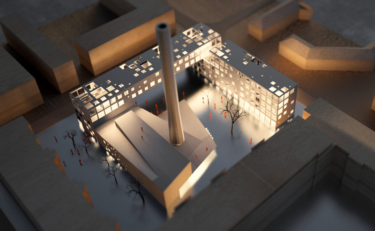
ramp up the 'mun
the physical model
The model of the building shows the relationship of the new flats to the old structure. The central square becomes a multifunctional public space for art.
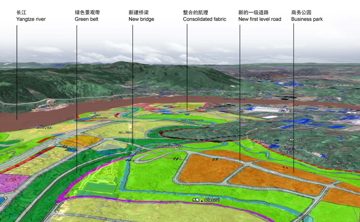
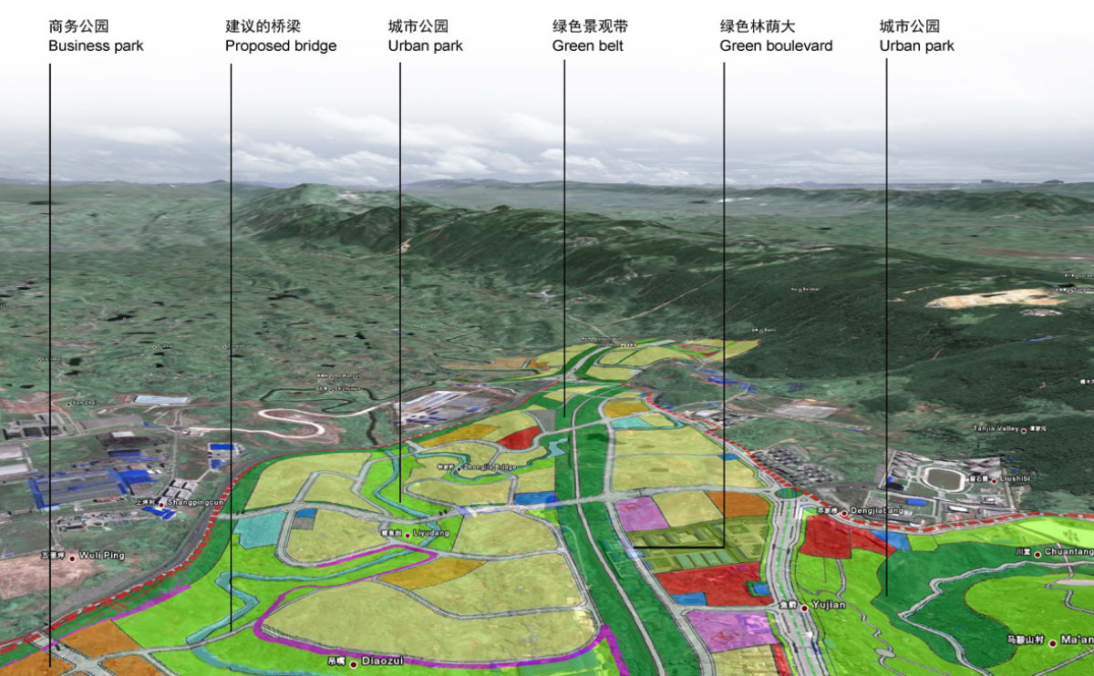
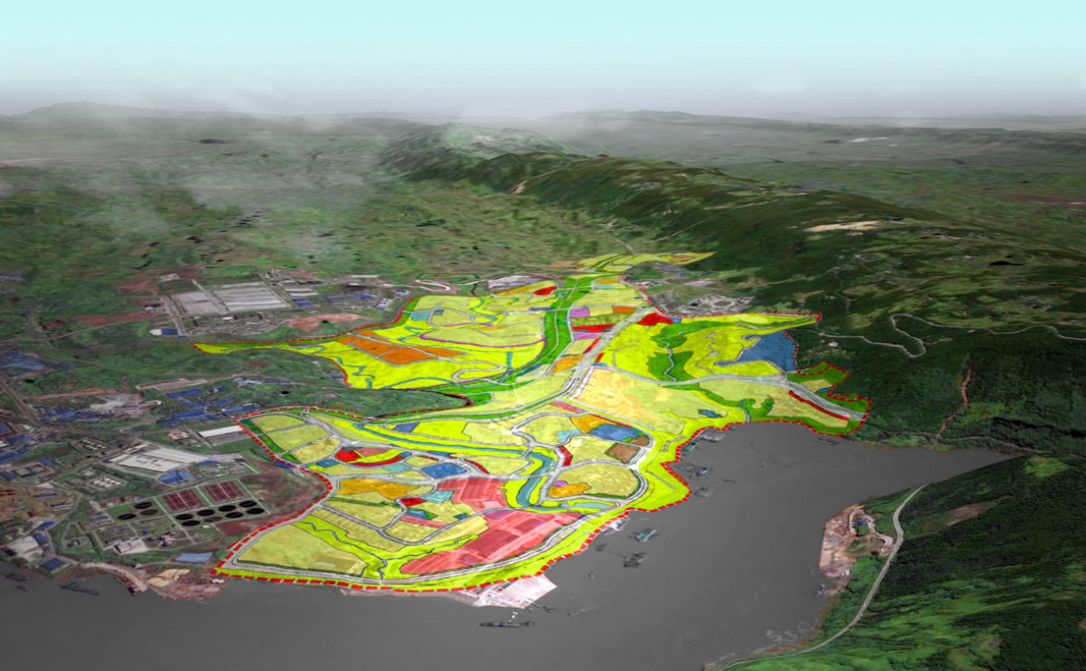
Tangjiatuo planning
the southwest detailed birdview
The western part of the master plan is bordering the consolidated urban fabric near the river. At the top of the hills a business centre is proposed, connected to the residential area by a bridge across the green belt of the valley.
maragato lofts
the physical model
The physical model accurately represents the building in its context, where the perforated facade, illuminated, completes the corner of the plot and sets up a dialogue with the surrounding urban fabric.
market eight
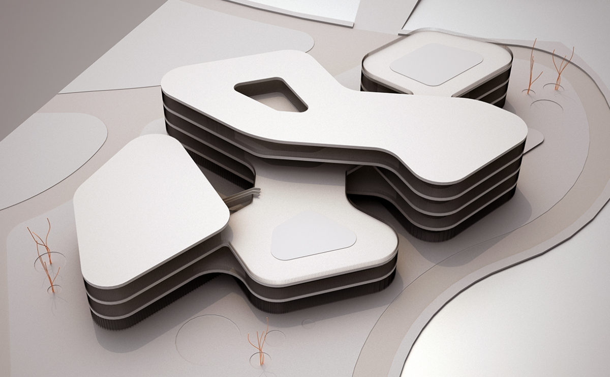
the physical model
The building’s five interconnected volumes are adapted to the shape of the plot, which is surrounded by a river. This configuration can be seen in the model, which also shows the courtyards and the façade.
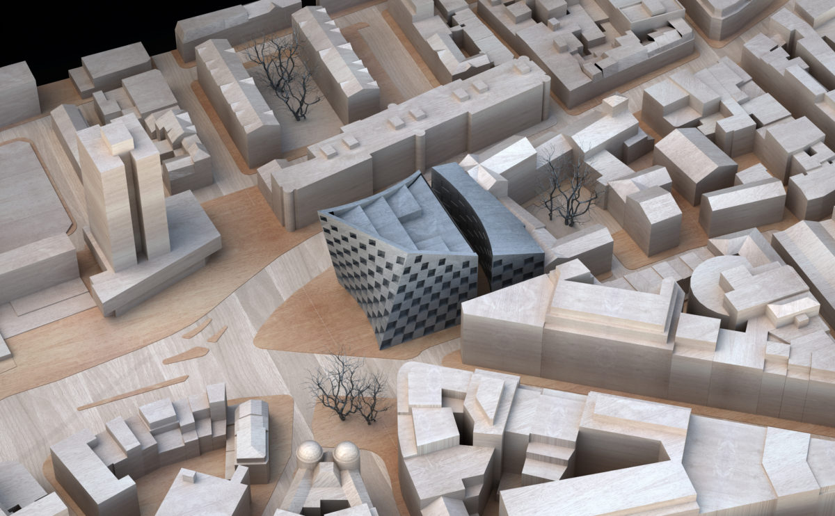
Shoreditch hotel
the site physical model
In comparison with the urban fabric surrounding the hotel, the form of the building stands out for its dynamism and fluidity. The effect of the façade can be seen in the surrounding model, where the building completes the block and offers a new urban facade to the square.
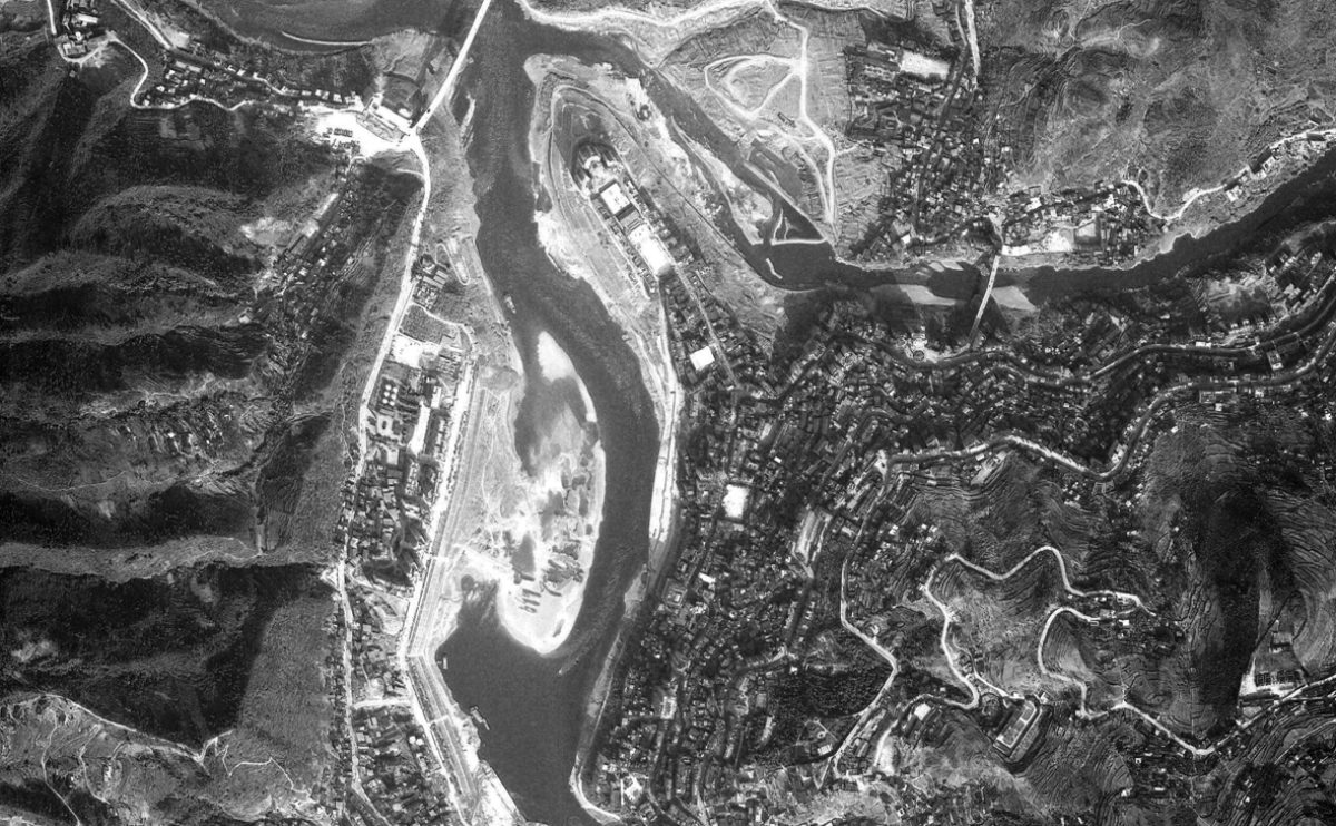
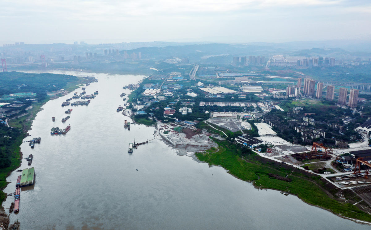
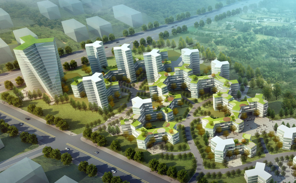
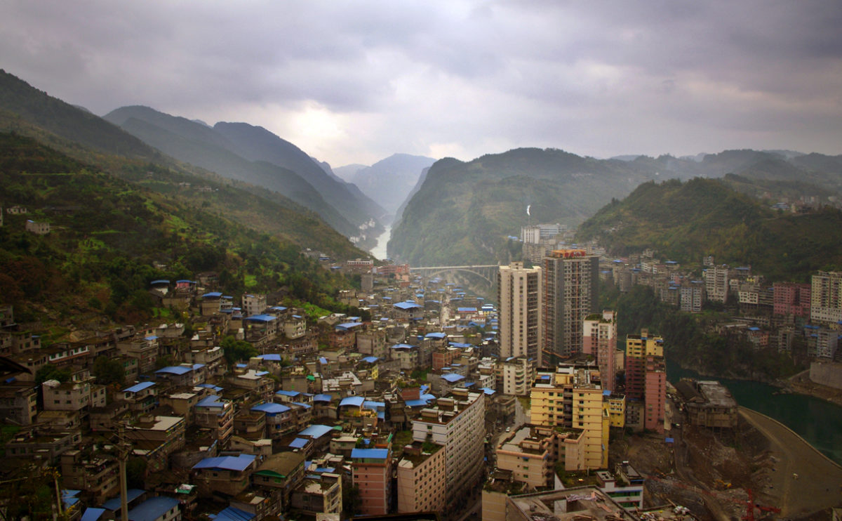
Pengshui city planning
the satellite image
The satellite image of the city of Pengshui shows the confluence of the rivers and the expansion of the city on both sides of the mountain.
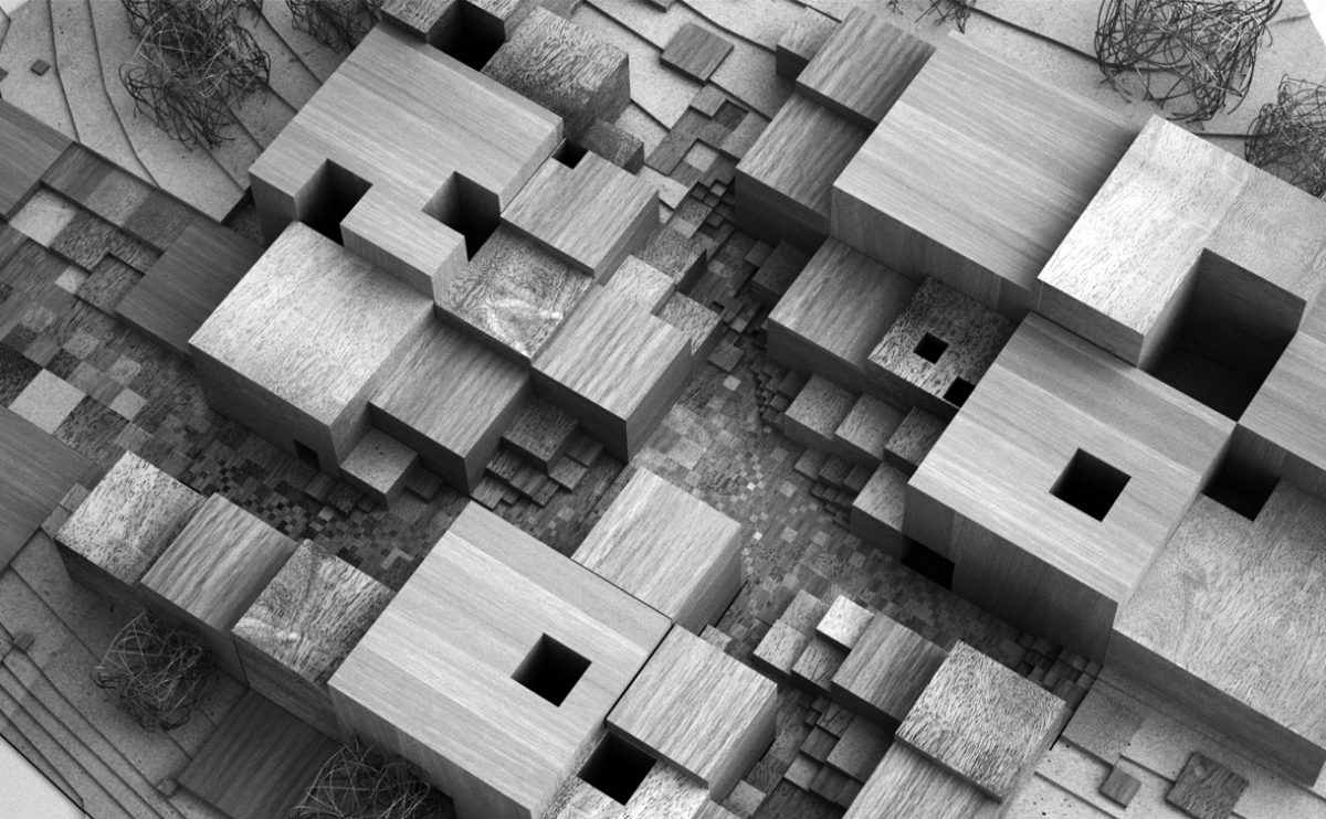
wrap manifesto
the physical model
The building is situated close to a steep slope, so the new extension also serves as a pedestrian bridge connecting the upper street with the main avenue. This secondary public access is linked to the access to the multi-purpose hall.
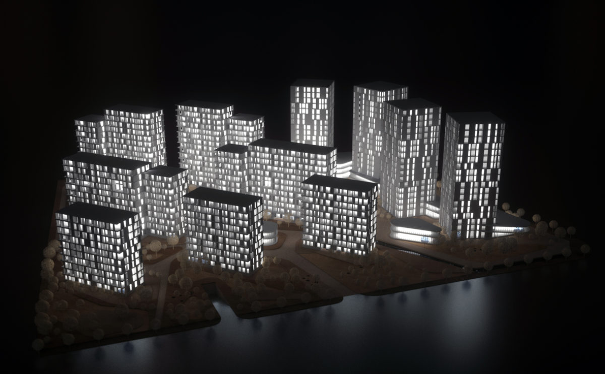
spliced towers
the physical model
The project model shows the relationship of the buildings to the landscape. The office towers have a free orientation while the residential blocks seek southern light and are oriented on a north-south axis.
Slatina square
the physical model detailed view
The urban design of Slatina Square features a series of circular elements that function as water features, gardens, kiosks or street furniture. The result is a fun and informal design that allows for multiple uses of public space.
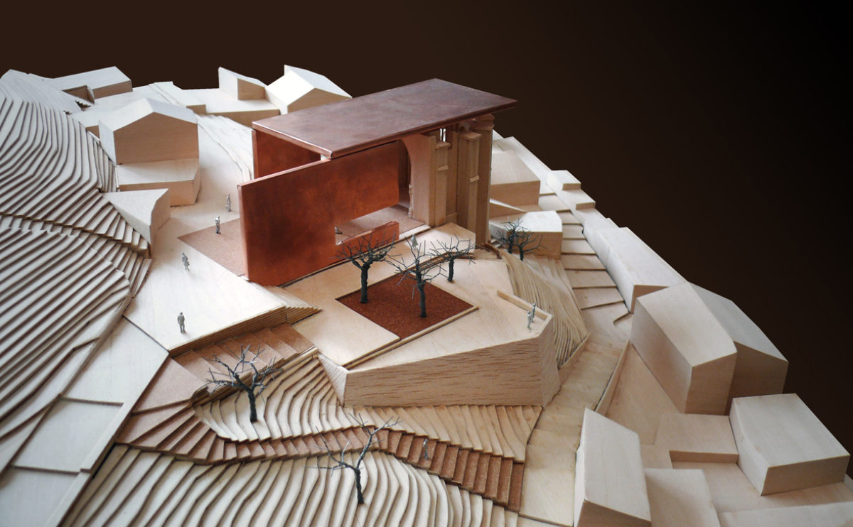
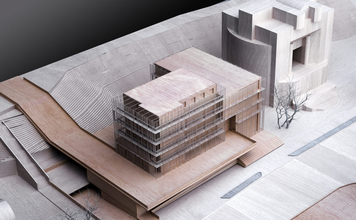
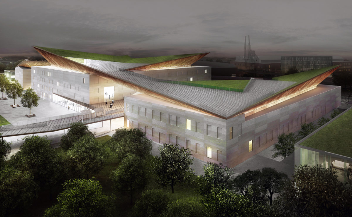
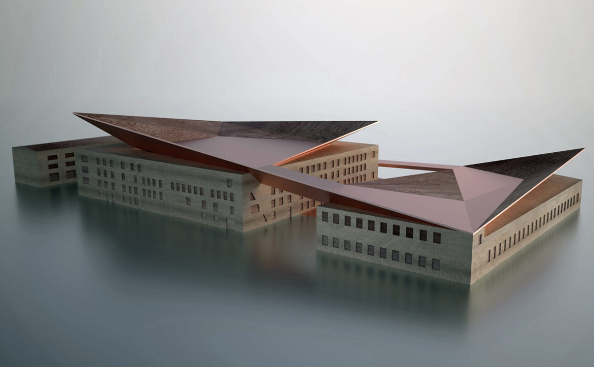
Atienza music hall
the architectural model
This three-dimensional representation, made of wood and copper, allows us to observe the project as a whole, and to understand how the accesses and levels are resolved in the steep terrain where the church is located.
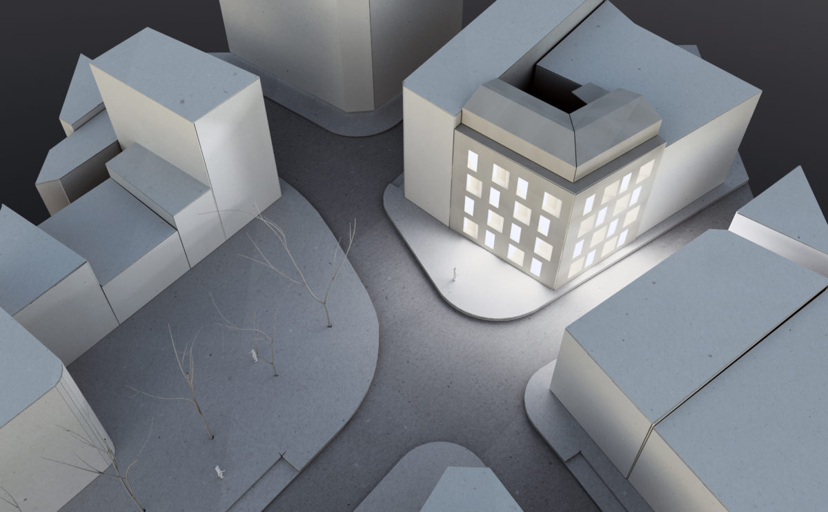
house of arts
the site model
The building completes an urban block in an area bordering the historic centre and a busy ring road.
house of arts
the physical model
The model of the building, which is made out of methacrylate, shows the concept of the architectural work: the House of Arts is made up of different capsules between round-shaped planes.
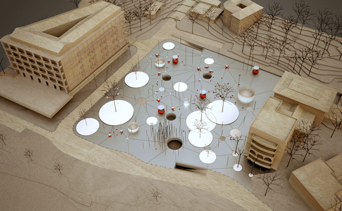
Slatina square
the physical model
The urban design of this square in front of the promenade is like a pattern of circles of different sizes. The skylights, lampposts, gardens and fountains are linked together like a constellation. The wood and aluminium model also shows the entrances to the underground car park beneath the square.
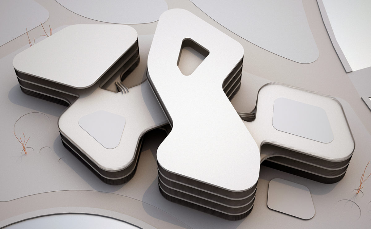
market eight
the physical model
The top view of the model of the building shows the meandering silhouette of the shopping centre. The zig-zag shape creates courtyards open to the landscape.
Tangjiatuo planning
the aerial view from the east
Aerial view of the Tangiatuo district in Chongqing city. The new urban design integrates the industrial character of the riverside with a new sustainable approach.
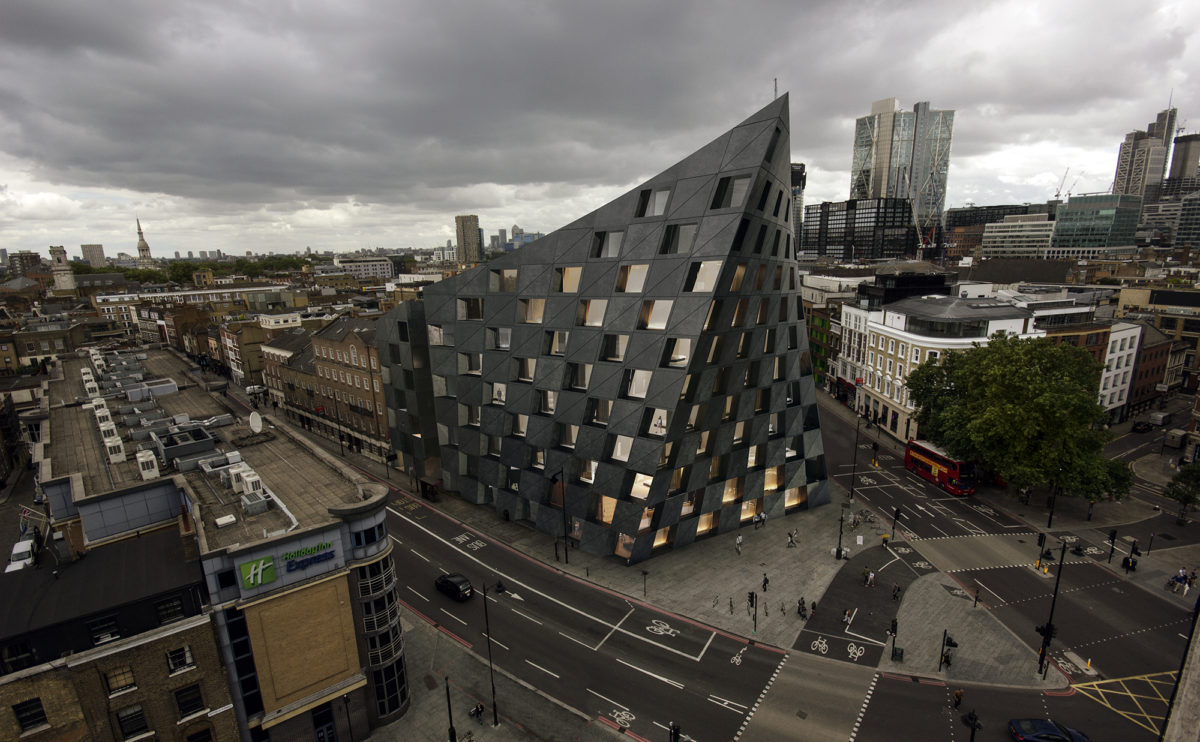
Shoreditch hotel
the aerial view
From the aerial view, the urban presence of the hotel can be seen in its context. The dark figure slightly turned towards the intersection and the design of its iconic checkered façade create a symbolic and recognisable image.
Tangjiatuo planning
the detailed northeast view
The eastern part of the master plan has a primarily residential use. The different sectors are connected with large green areas that correspond to the valleys and rivers and serve as urban parks.
elemental complex
the birdview
The buildings occupy the plot in a hexagonal pattern. The hotel towers and offices are located in the north, while the urban density descends towards the south.
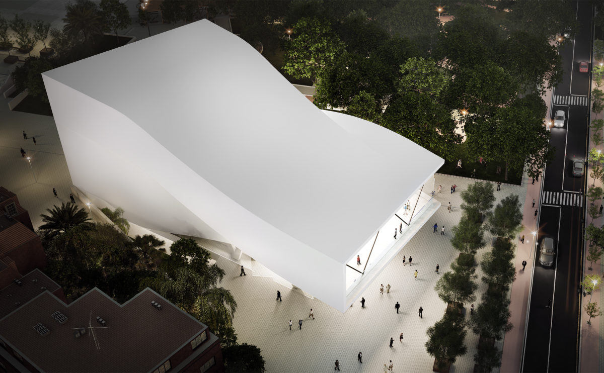
folded auditorium
the bird view
A bird’s eye view shows the sinuous shape of the auditorium roof. This white concrete building has a folded shape that contrasts with the vegetation of the urban park.
Tangjiatuo planning
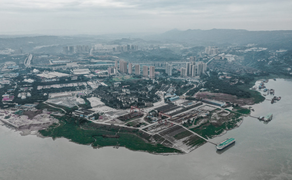
the aerial view from the south
Aerial view of the Tangjiatuo district in Chongqing city. The urban master plan proposes a new land-use distribution while preserving the old town.
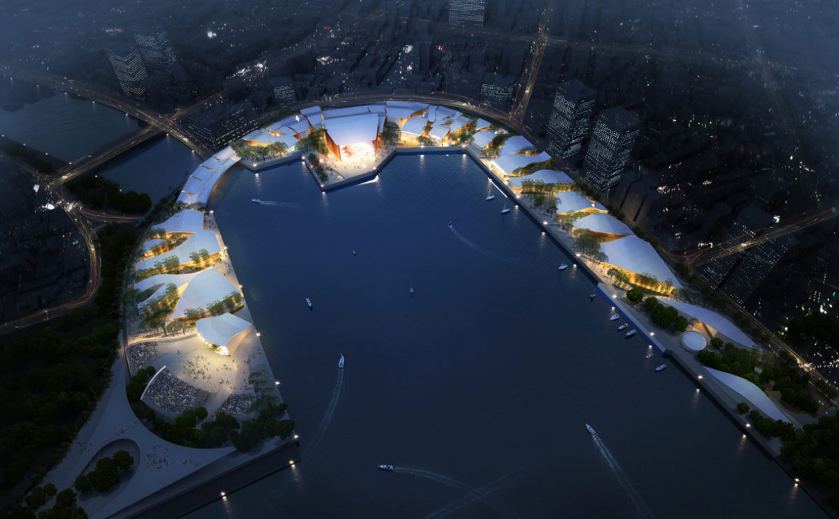
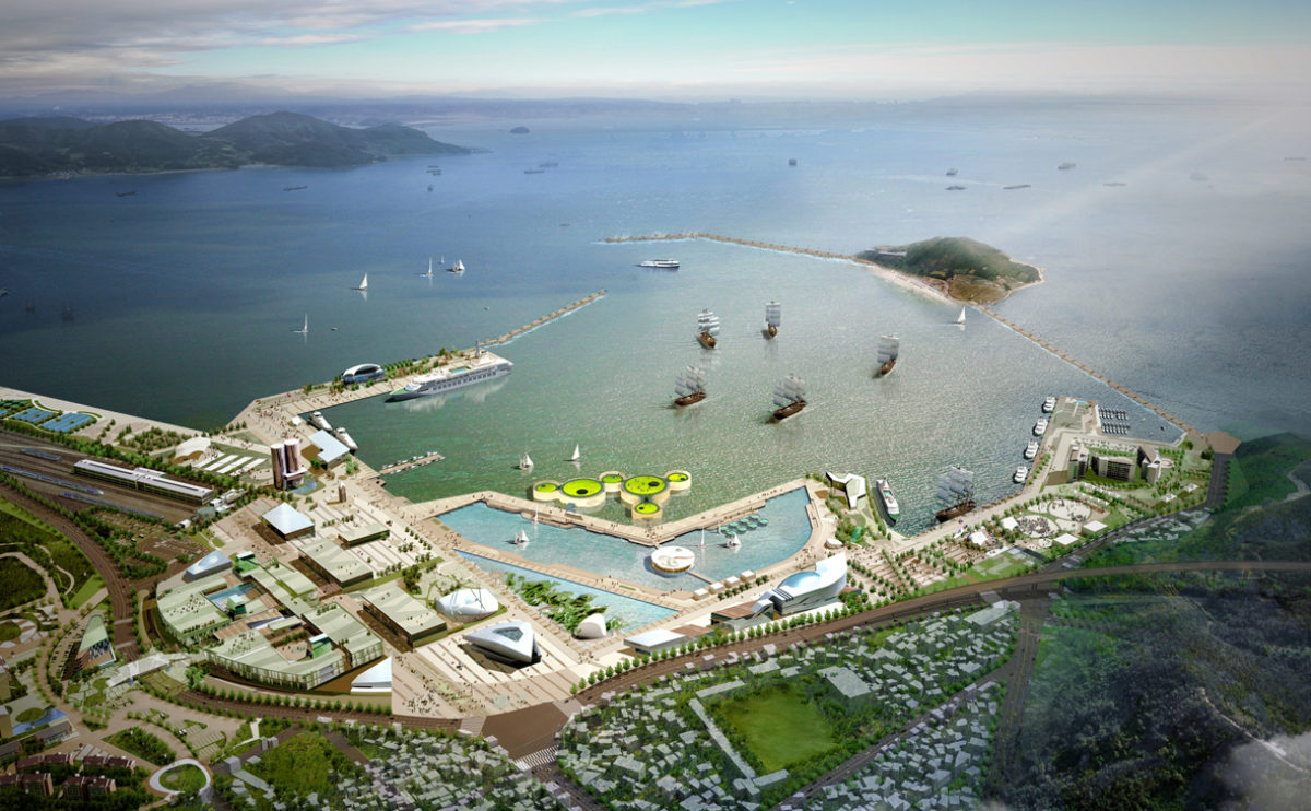
performing arts complex
the birdview
The bird’s eye view of the performing arts complex shows the radial layout of the master plan, with buildings covered with undulating roofs around the marina.
Pengshui city planning
the aerial view
Pengshui is a city set in a mountainous landscape that has grown without planning, resulting in infrastructure and diversity problems. The strategic plan proposes a package of measures to improve the quality of life through urban planning.
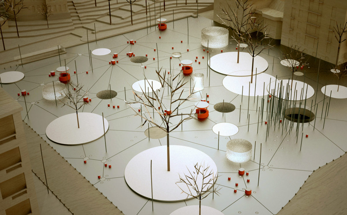
Slatina square
the birdview
The bird’s eye view of the square shows the street lighting system, consisting of flexible illuminated poles that move in the wind to create a dynamic effect. The spatial organisation of the square is based on circular shapes.
Tangjiatuo planning
the masterplan birdview
The visualisation shows the master plan applied to the topography of the terrain. The colours indicate the land use, which makes it possible to appreciate the relationship between the infrastructure and the slope.