Tangjiatuo planning
AQSO arquitectos office tangjiatuo plannig, bird view, mountainous landscape, land use, river, overview, bird view, aerial, river, industrial city, transformation, regeneration, new uses, mountains, value increase, real estate, appealing location, urban design

the masterplan birdview

The visualisation shows the master plan applied to the topography of the terrain. The colours indicate the land use, which makes it possible to appreciate the relationship between the infrastructure and the slope.

4/10

work Tangjiatuo planning

the masterplan birdview

office

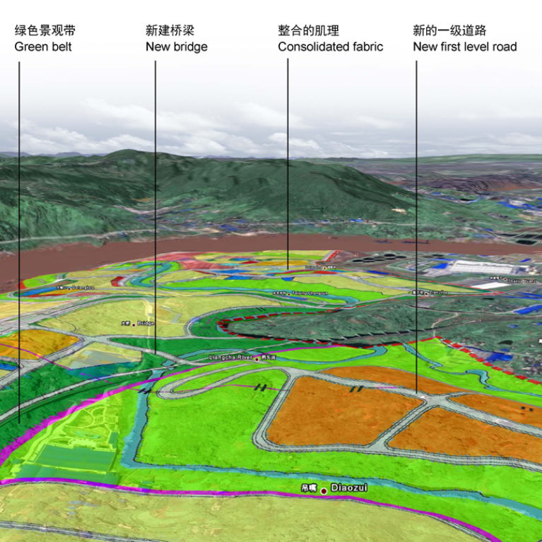
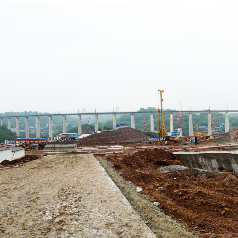
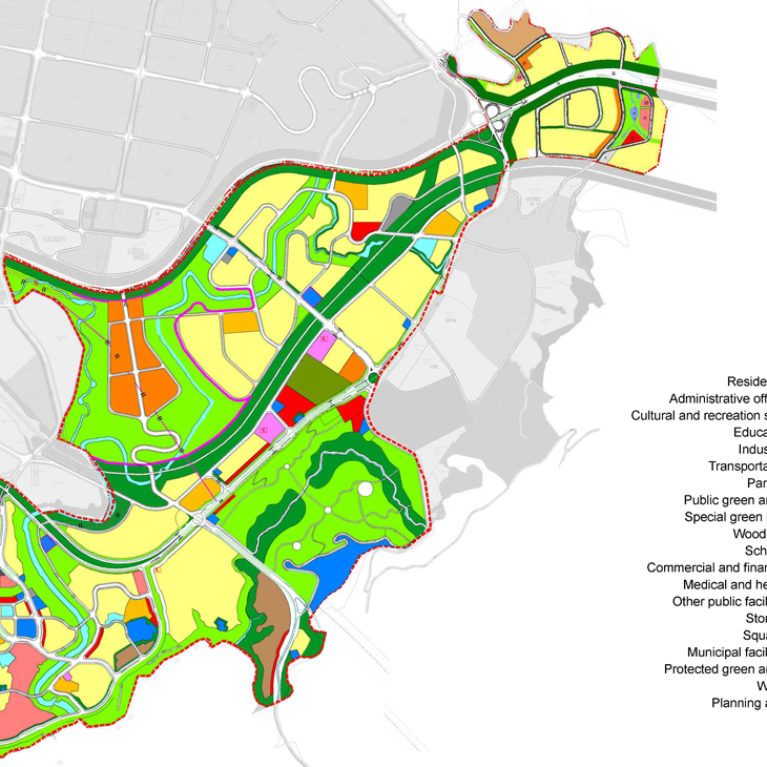
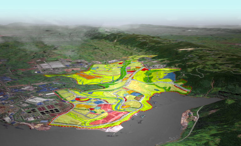
It is difficult to perceive the urban layout in a plan representation, however, when mapping the terrain, the relationship between land use and changes in level can be perceived.

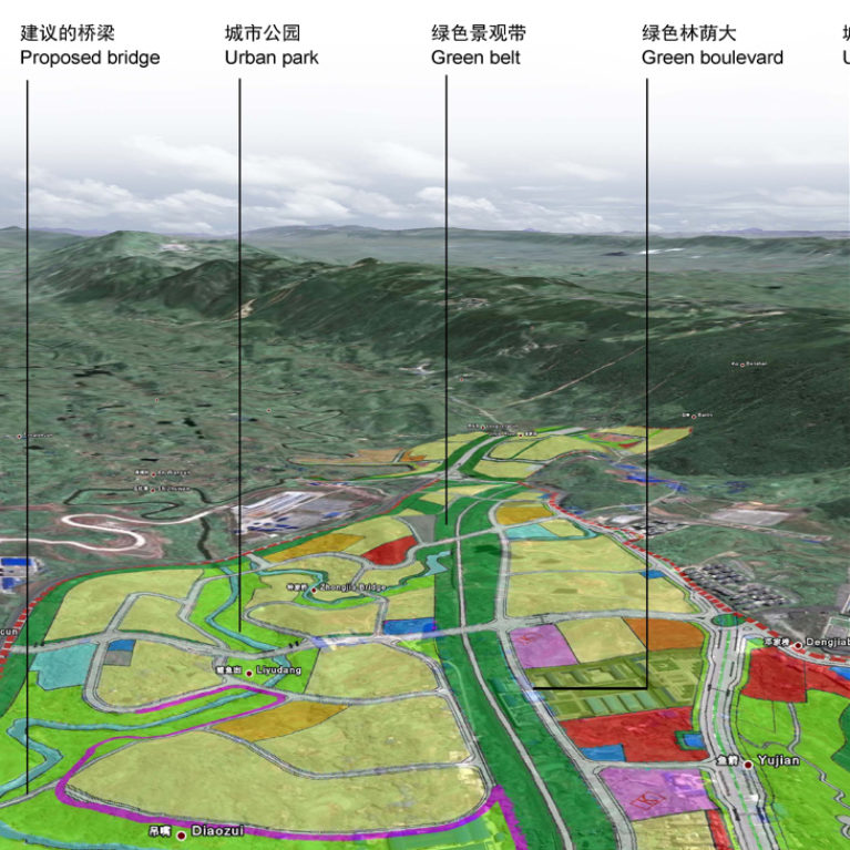
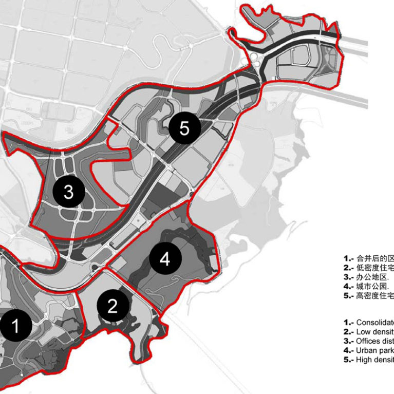
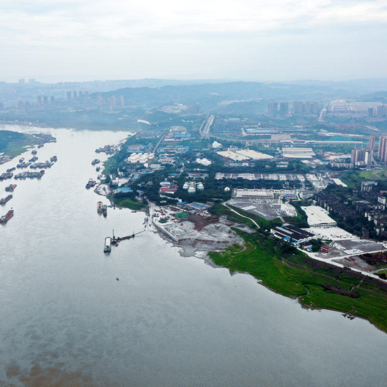
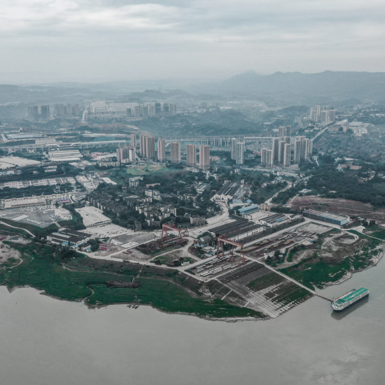
From the old consolidated area to the east, the new neighbourhood extends inland and to the west along the riverbank.

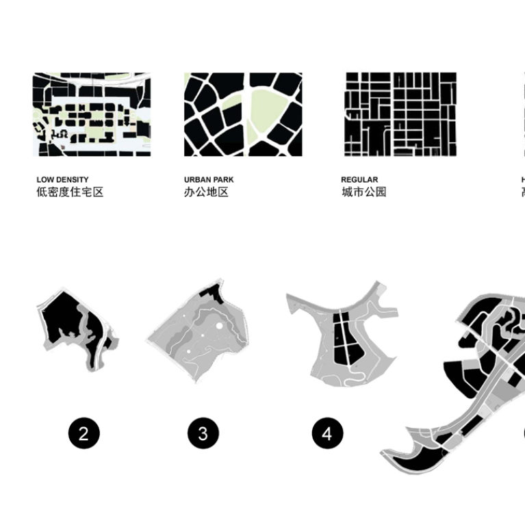
Most of the land use is residential. Minimal industrial activity associated with the old river shipyards is maintained. The business centre occupies the top of the hill and is served by one of the new railway stations.

#
birdview
site plan

More on this work

AQSO arquitectos office, tangjiatuo planning, land use, 3d terrain, mapping, industrial areas, diaozui, yangze river, chongqing, green belt, city planning, expansion areas, new developments, levelling, embankment, slope

the southwest detailed birdview

AQSO arquitectos office, tangjiatuo plannig, bird view, mountainous landscape, land use, river, 3d mapping, sectors, urban analysis, tridimensional scan, geolocation, satellite image, diagram, city planning tools, road system, territorial division

the detailed northeast view

AQSO arquitectos office, tangjiatuo planning, map, sectors, intervention areas, urban fabric types, breakdown, comparison, urban analysis, density, mountainous landscape, city on a hill, urban morphology, lots

the urban fabric study

AQSO arquitectos office, tangjiatuo planning, map, sectors, intervention areas, urban fabric types, city planning, consolidated center, low density residential, urban park, high density, diverse city, regeneration, architectural services

the urban districts

AQSO arquitectos office. Works of the Tangjiatuo residential district in Chongqing, the new urban network of streets provides an efficient transportation system in line with the urban density.

the urban infraestructure

AQSO arquitectos office. Aerial view of the Tangiatuo district in Chongqing city. The new urban design integrates the industrial character of the riverside with a new sustainable approach.

the aerial view from the east

AQSO arquitectos office. Aerial view of the Tangjiatuo district in Chongqing city. The urban masterplan proposes a new land use distribution while preserving the old town.

the aerial view from the south

AQSO arquitectos office, tangjiatuo planning, land use and districts, residential, offices, recreation sites, education, industrial use, commercial financial district, municipal facilities, protection levels, woodland

the land use plan

AQSO arquitectos office, tangjiatuo planning, urban mobility, transportation system, road hierarchy, monorail stations, coverage radius, circulation levels, reach area, influence, train station, catalyst, heatmap, value increase, commute, diagram, transportation design, urban design, architects

the urban mobility study

  • en
  • es
©
work
city planning
commercial buildings
public buildings
residential
urban design
office
practice
solutions
publications
news
contact
talent
site map