A site plan is a drawing that depicts the layout and features of a piece of land, showing the location, orientation and dimensions of buildings, structures, and other features on the site. Site plans are an important tool in the design and development of buildings and other structures, as they provide a detailed representation of the land and its features.
Site plans typically show the boundaries of the site, the location and dimensions of buildings and structures, and the location and dimensions of other features such as roads, walkways, utilities, and landscaping. They may also include topographic information, such as the contours and slopes of the land, and they may show the location and dimensions of rights-of-way, easements, and other legal considerations. Site plans can be represent the findings of a specific site analysys.
Site plans can be used to explore the functional, spatial, and environmental aspects of a site, and to study the relationships between different site features and the surrounding context. Site plans can also be used as a means of communication between designers, developers, and other stakeholders, and they can be used to convey ideas and concepts related to the development of a site.
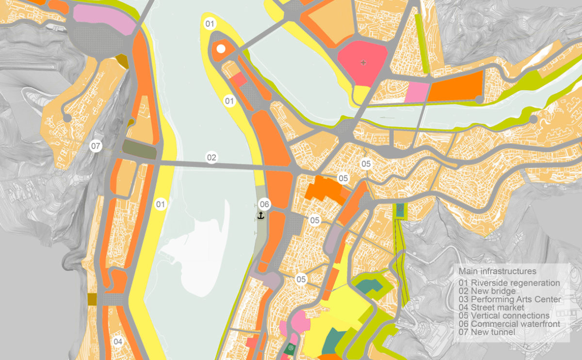
Pengshui city planning
The strategic plan for the city centre
The strategic plan for the city centre defines the land uses, special conservation areas and the main infrastructures needed to revitalise the city and clean up the city.
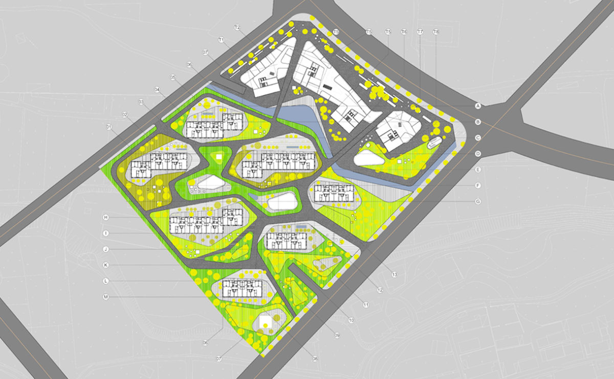
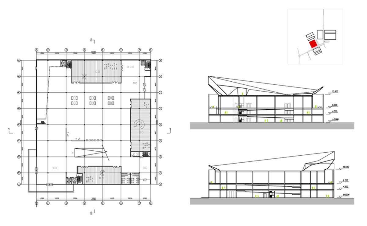
spliced towers
the master plan
The building complex comprises a residential area and a set of office towers on a podium for commercial use. The landscape design adopts a fluid, organic language that contrasts with the orthogonal composition of the buildings.
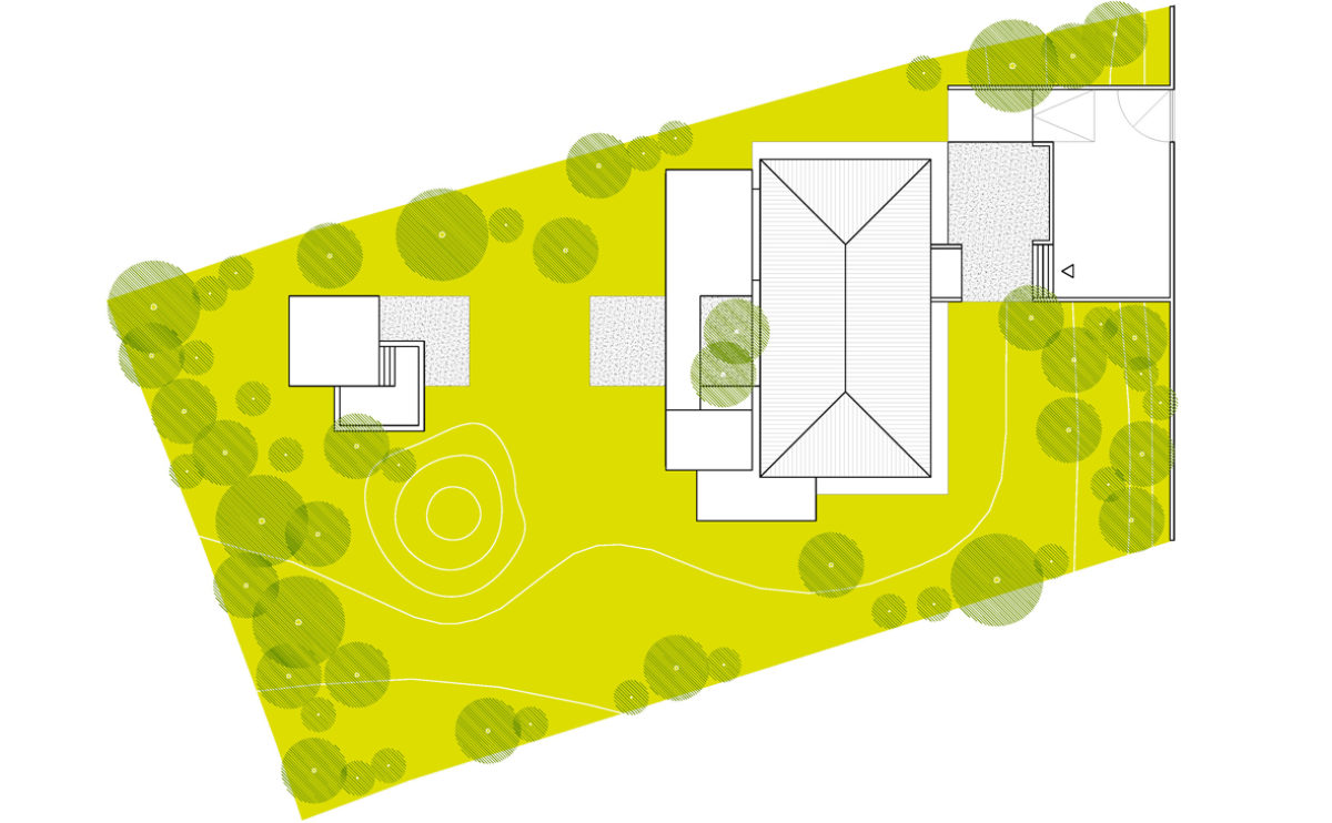
Burke house
the site plan
The floor plan shows the position of the original dwelling and the extension. The entrance has generous parking space and there is a pavilion in front of the house with a jacuzzi.
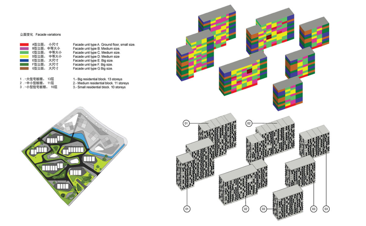
spliced towers
the residential facade diagram
The façade of residential buildings is made up of a variety of openings that change in size depending on the incidence of sunlight on the buildings.
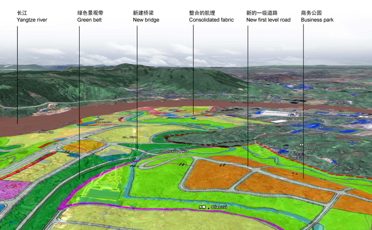
Tangjiatuo planning
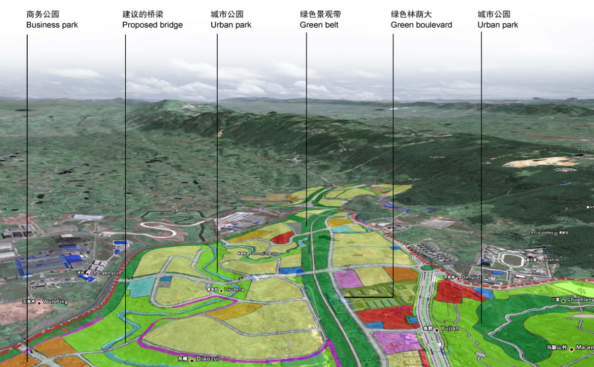
the masterplan birdview
The visualisation shows the master plan applied to the topography of the terrain. The colours indicate the land use, which makes it possible to appreciate the relationship between the infrastructure and the slope.
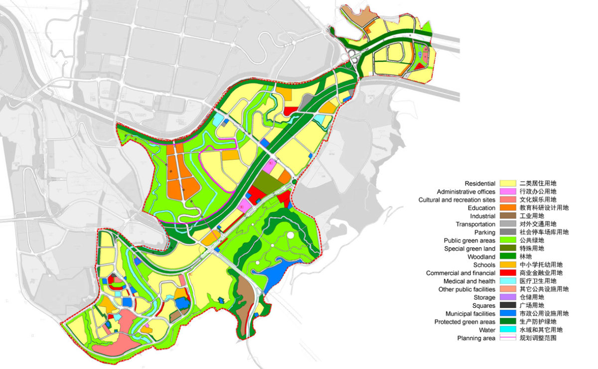
Pengshui city planning
the urban development plan
Town planning map of Dianshui District. This is an expanding area of the city, a new neighbourhood conceived with a diverse and sustainable urban fabric.
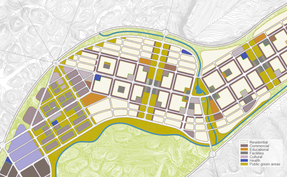
Tangjiatuo planning
the detailed northeast view
The eastern part of the master plan has a primarily residential use. The different sectors are connected with large green areas that correspond to the valleys and rivers and serve as urban parks.
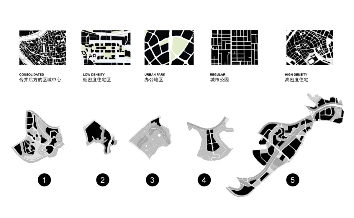
Tangjiatuo planning
the urban fabric study
The comparative study of the different urban fabrics distinguishes five types of morphology: consolidated fabric, low density, urban park, regular compact fabric and high urban density.
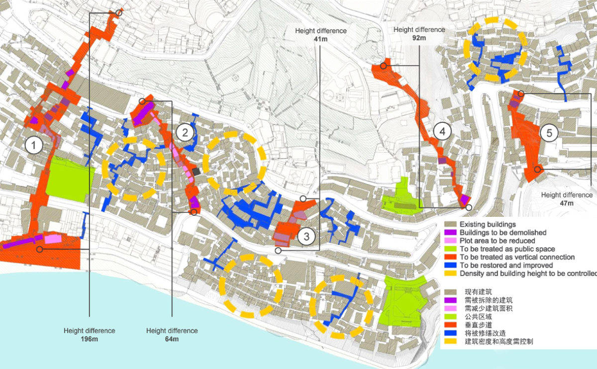
Pengshui city planning
the detailed urban mobility study
This detailed urban mobility study aims to establish stairs and lifts to improve pedestrian circulation and regenerate the sloping urban fabric.
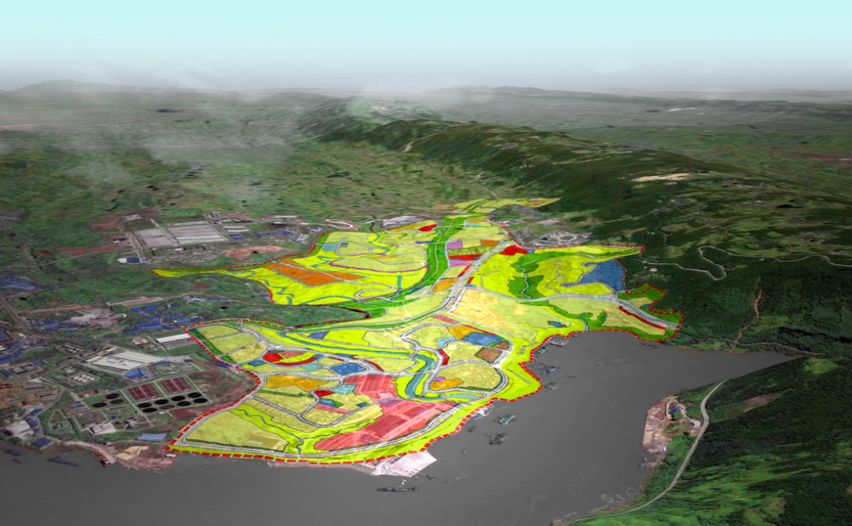
Tangjiatuo planning
the southwest detailed birdview
The western part of the master plan is bordering the consolidated urban fabric near the river. At the top of the hills a business centre is proposed, connected to the residential area by a bridge across the green belt of the valley.
Tangjiatuo planning
the land use plan
The land use map shows the different districts and their urban fabric. It distinguishes residential areas, offices, recreational areas, financial centres, public and commercial buildings, among others.
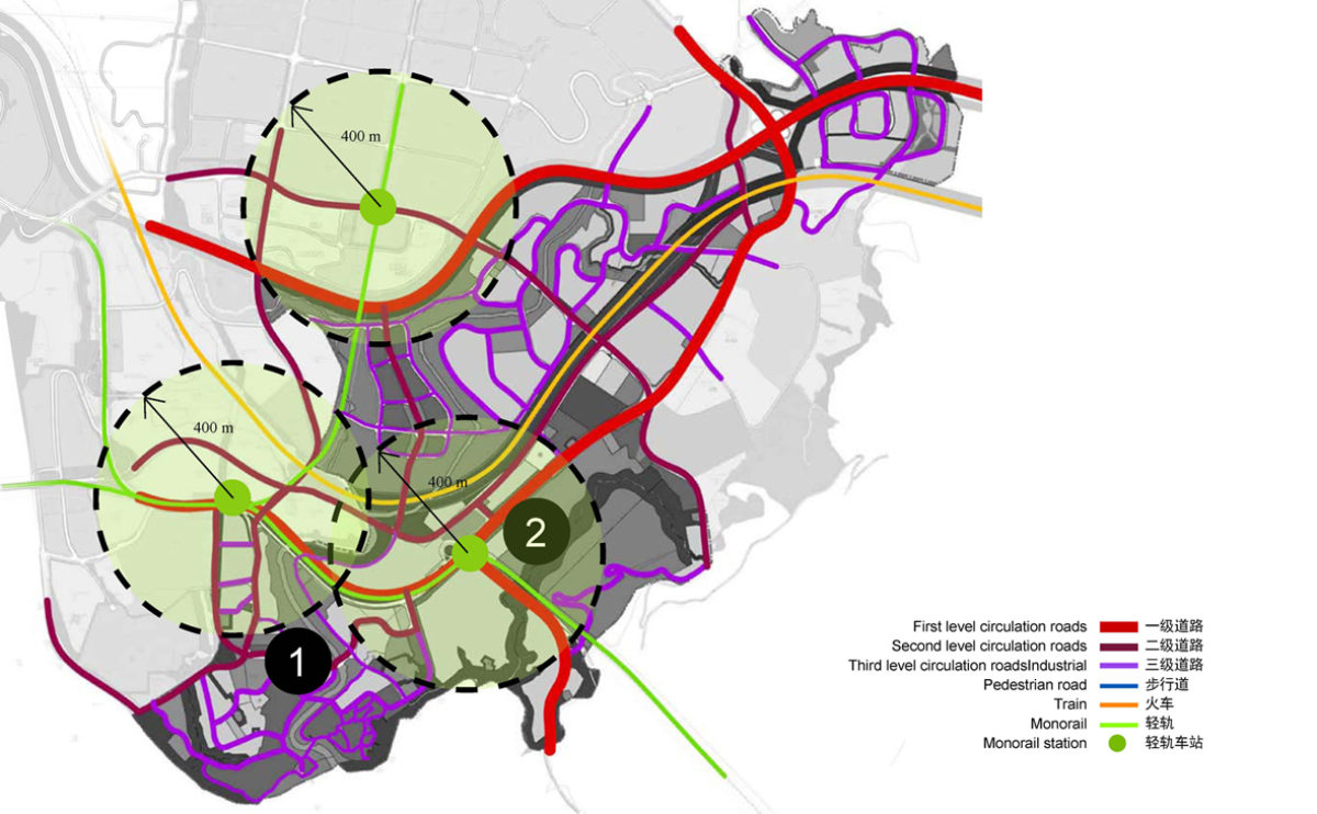
Tangjiatuo planning
the urban mobility study
Urban mobility is based on a road system for vehicular traffic, a network of pedestrian and bicycle paths, a long-distance public transport system and a monorail connecting the different districts.
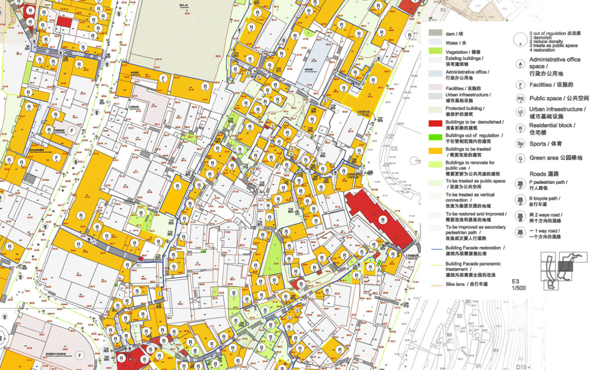
Pengshui city planning
the building protection study
The strategic urban plan assigns different levels of protection to the buildings in the conservation area depending on their architectural value and use.
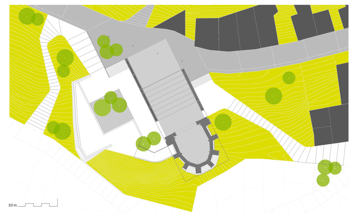
Atienza music hall
the site plan
The intervention integrates the building into its surroundings through comprehensive landscape design. The new access ramps, the trees and the gardens help to enhance the monument in context.
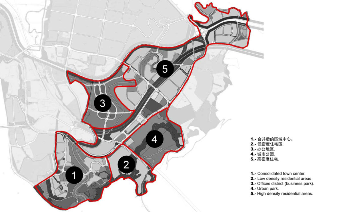
Tangjiatuo planning
the urban districts
The master plan is divided into five districts characterised by the type of urban fabric: consolidated centre, low-density residential area, financial district, urban park and high-density residential area.
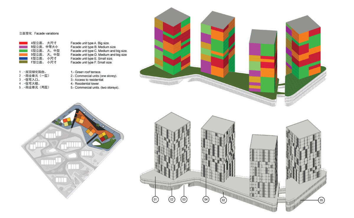
spliced towers
the office facade diagram
The façade of office buildings is made up of a variety of openings that change in size depending on the orientation and incidence of the sun on the towers.
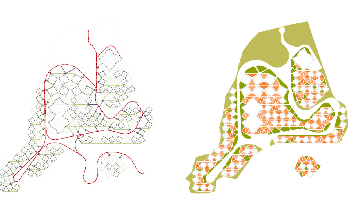
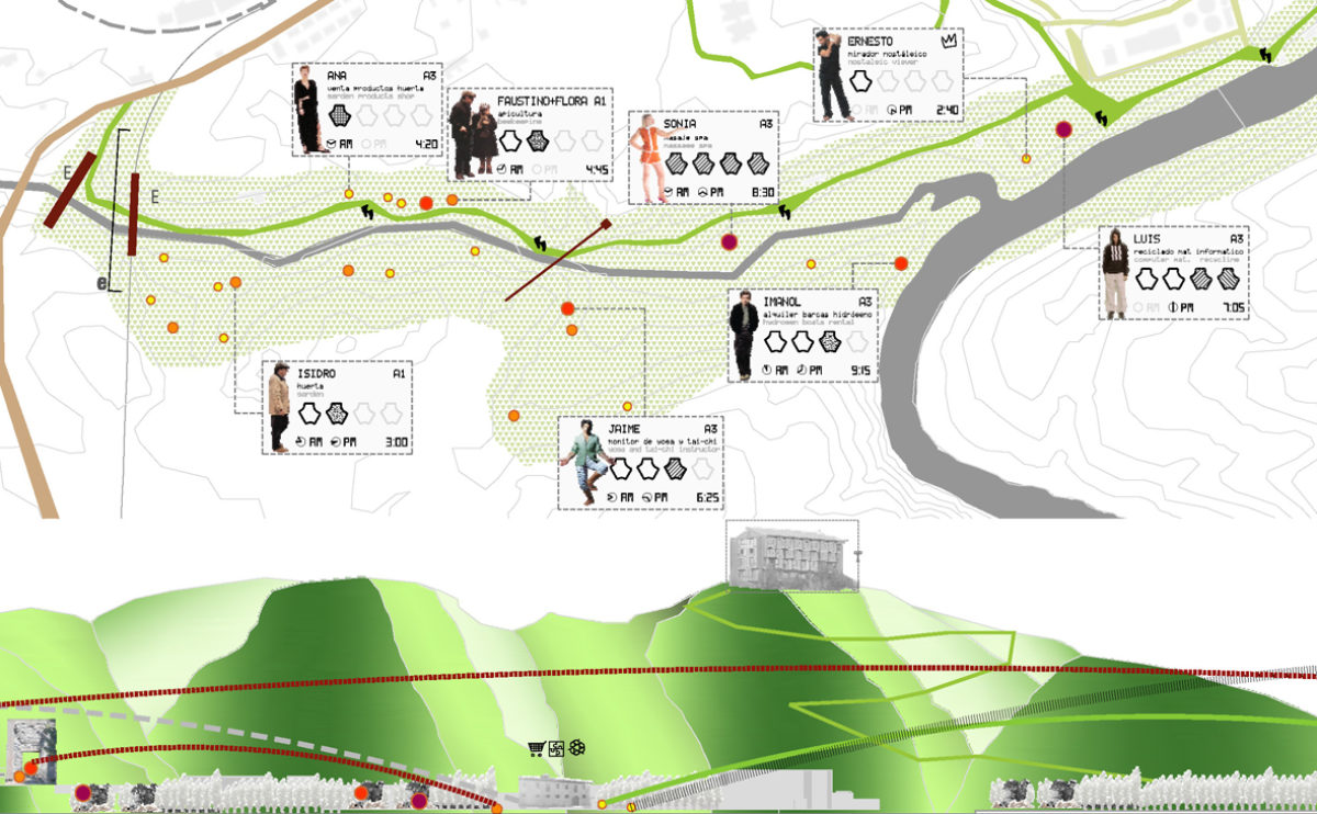
Dehan village
the circulation and land use diagrams
The general layout of the resort is determined by the orography of the land. There is a primary road system that allows vehicle access, through which pedestrian access is then provided to the different groups of homes within the triangular gardens.